Everest Map & Key Locations
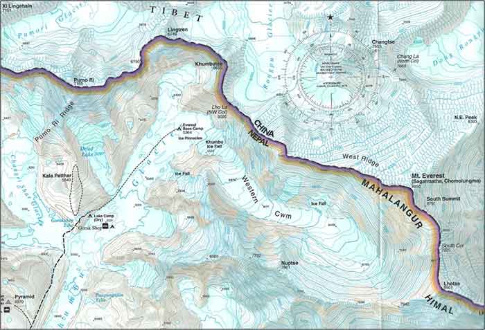
To the human eye, Everest is a soaring fortress of jagged rock towers, crevasse-riddled glaciers, and looming ice cliffs. Below is a topographic map of Mount Everest (metric units) that tries to convey all that majesty.
On the right is the summit (8,850 meters, or 29,035 feet), along with the mountain’s traditional names of Sagarmatha (Nepali) and Chomolungma (Tibetan). The dashed line leading to Everest Base Camp shows the last few hours of the 12-day approach trek.
| KEY LOCATIONS ON EVEREST | Elevation (meters) | Elevation (feet) |
|---|---|---|
| Base camp | 5,384 m | 17,593 ft |
| Khumbu Glacier Icefall | 5,400 – 5,950 m | 17,800 – 19,500 ft |
| Camp 1 | 5,950 m | 19,500 ft |
| Camp 2 (Western Cwm) | 6,400 m | 21,000 ft |
| Camp 3 (Lhotse Face) | 7,470 m | 24,500 ft |
| Camp 4 (South Col) | 8,016 m | 26,300 ft |
| Summit | 8,850 m | 29,035 ft |
Elevations approximate.